
Prey Veng Province (ខេត្តព្រៃវែង) is one of Cambodia’s most populous and historically significant provinces, situated in the country’s southeastern region on the east bank of the Mekong River. With a population that topped 1.16 million people in 2023, Prey Veng ranks as the third most populated province in Cambodia, and it is known for its extensive agricultural landscape and profound cultural heritage.
Geography and Location
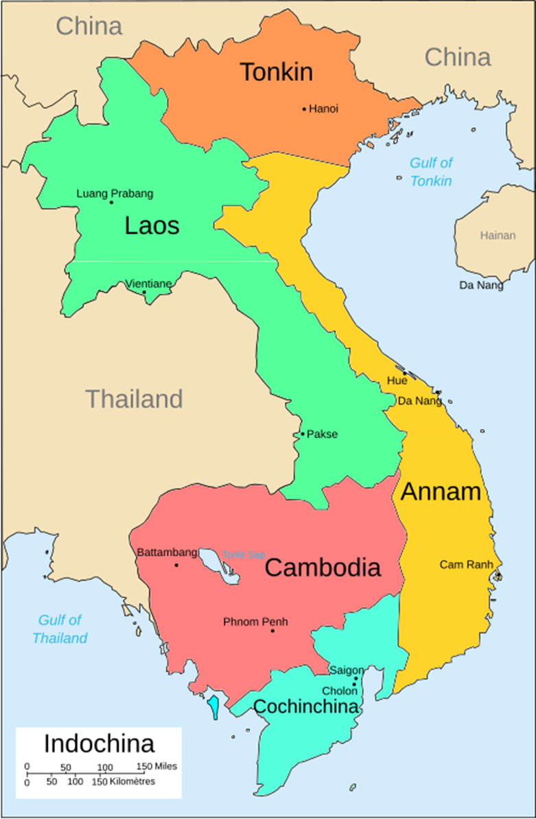
Prey Veng covers an area of approximately 4,883 square kilometers. It borders several Cambodian provinces, including Svay Rieng to the east, Kampong Cham and Tboung Khmum to the northwest and northeast, and Kandal to the west. The province also shares an international border with Vietnam to the south, specifically with Dong Thap, Long An, and Tay Ninh provinces. This geographical setting makes Prey Veng not only agriculturally prominent but also accessible: it is about a two-hour drive from Phnom Penh, the Cambodian capital.
Its physical geography is dominated by flat lowlands and fertile floodplains. These areas are ideal for rice cultivation due to their soil richness and periodic flooding during the monsoon season, which typically runs from May to October. The province is intersected by the Mekong and Bassac rivers, which, along with their tributaries, are invaluable for irrigation, transportation, and fishing. As such, the land use is primarily agricultural, with wetlands playing a significant role in the local ecosystem.
Historical Background
Prey Veng’s history stretches back to the early centuries of the Christian era when the region was a vital part of the ancient kingdom of Funan. Funan was among Southeast Asia’s earliest advanced civilizations, and Prey Veng was situated between the major centers of Oc Eo (now in Vietnam) and Angkor Borei (in present-day Takeo province, Cambodia). As the Funan kingdom declined and the Chenla polity rose in prominence, the region’s centrality diminished, though it continued to be culturally significant.
During the Khmer Empire’s height, Prey Veng contributed as a major rice-growing area, essential to supporting the empire’s large population and ambitious constructions like Angkor Wat. After the decline of the empire in the 15th century, the province became contested ground, affected by the ambitions of neighboring Siamese (Thai) and Vietnamese empires.
The French colonial era (established in 1863) brought significant changes: the administration recognized Prey Veng’s potential for agriculture and fishing, prompting mass deforestation to create farmland. These policies laid the groundwork for the province’s current agricultural prominence.
The darkest chapter in Prey Veng’s history came during the Khmer Rouge regime (1975–1979). Like much of Cambodia, the province suffered famine, mass displacement, forced labor, and grave atrocities, resulting in thousands of deaths. After the Vietnamese intervention in 1979, Prey Veng was among the early regions to be liberated from Khmer Rouge control.
Population and Culture
With its 1.1 million inhabitants, Prey Veng is among Cambodia’s densest and most rural provinces. The vast majority—over 99.5%—of residents follow Theravada Buddhism, which is the state religion. Minority religious communities include Muslims (mostly the Cham people) and a small number of Christians.
The province maintains a distinct rural character, with most of the population engaged in farming. Traditional wooden houses, bustling local markets, Buddhist pagodas, and rice fields define the local landscape. Despite its size and economic importance, Prey Veng remains relatively undiscovered by tourists, preserving a quiet, community-driven atmosphere.
Administration and Economy
Prey Veng is divided into 12 districts and one municipality, Prey Veng City, which is the provincial capital and administrative hub. The districts include Ba Phnum, Kamchay Mear, Kampong Trabaek, Kanhchriech, Me Sang, Peam Chor, Peam Ro, Pea Reang, Preah Sdach, Pur Rieng, Sithor Kandal, and Svay Antor.
Agriculture is the backbone of Prey Veng’s economy. It is Cambodia’s largest rice-producing province, responsible for about 10% of the national rice crop output and generating significant surpluses most years. Other key crops include:
- Tobacco
- Mung beans
- Cassava
- Sugar (both cane and palm)
- Sesame
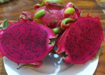
- Fruits such as coconuts, mangoes, and cashews
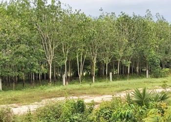
Rubber plantations used to be important before war disrupted the sector. Fishing is another major livelihood, enabled by the province’s rivers and wetlands.
Tourist Attractions and Sites
Prey Veng is not a major stop on Cambodia’s tourist trail, but offers several notable attractions for visitors interested in history, culture, and rural scenery:
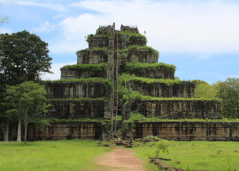
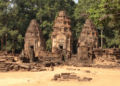
- Ba Phnom: This ancient site, located 78 kilometers from Phnom Penh and south of Prey Veng town, features a 139-meter mound that was a major spiritual and cultural center as far back as the Funan period. Archaeological evidence shows it was a place of worship for both Hindu and Buddhist devotees, as well as animist rituals.
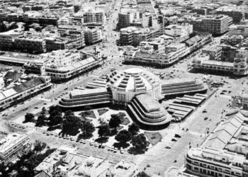
- Prey Veng Town: The capital has a quiet charm, with French colonial architecture, local markets, and a large seasonal lake. It serves as the province’s cultural and economic center.
- Temples and Pagodas: The province is dotted with centuries-old wats (Buddhist temples), reflecting both its historical continuity and spiritual life.
- Fish Growing Center in Bati Village: Offers insights into traditional fishing practices, an essential part of local livelihoods.
- Viel Brang (Kampong Leav Commune): A relatively less-known nature and wildlife preserve suitable for hiking and eco-tourism.
Transportation and Connectivity
Major national roads (like National Road 1 and 11) traverse Prey Veng, linking Phnom Penh with Vietnam, supporting trade and ease of travel for both goods and people. The province hosts three international border gates plus several regional checkpoints, facilitating cross-border movement that is vital for local commerce.
Challenges and Development
Despite its agricultural productivity, Prey Veng faces challenges such as poverty, underdeveloped infrastructure, and vulnerability to climate-induced events like flooding and drought. These realities are most keenly felt in rural districts such as Mesang, where lack of paved roads and basic services remain ongoing issues.
Recent years have seen gradual improvements, with increased attention to rural development, infrastructure upgrades, and the promotion of education and health services. The province’s strategic location near Phnom Penh and Vietnam, coupled with steady population growth, suggests potential for further socioeconomic progress, especially if opportunities in agribusiness, eco-tourism, and cross-border trade are harnessed.
In summary, Prey Veng Province stands as a microcosm of Cambodia’s agricultural heartland, shaped by centuries of history, endowed with fertile lands, and sustained by a resilient rural community. Its story is marked by both struggles and resilience—a place where ancient civilizations left their mark, colonial ambitions re-mapped its future, and the present continues to be defined by the land, rivers, and the people who call it home.


