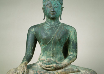
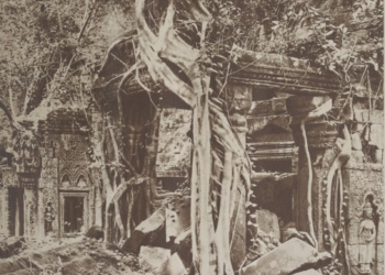
The ancient Khmer Empire, centered in Angkor, Cambodia, is remembered not only for its monumental stone temples such as Angkor Wat and Bayon but also for its extraordinary hydraulic engineering. Water was the foundation of Angkorian civilization. The Khmer built an intricate network of reservoirs, canals, embankments, and moats, creating one of the most sophisticated water management systems in the pre-modern world. These structures were not only feats of engineering but also instruments of economic prosperity, political control, and spiritual symbolism. The story of Angkor’s hydraulic system is one of ingenuity, ambition, and adaptation to a challenging tropical environment.

Water as the Lifeblood of Angkor
Angkor flourished in the fertile plains of northwestern Cambodia, a landscape defined by the Tonle Sap Lake, the Mekong River basin, and seasonal monsoon rains. The environment was both a blessing and a challenge. The monsoon brought abundant water during the wet season, but the dry season stretched for months, threatening drought and crop failure. This cycle of extremes compelled the Khmer kings and their engineers to develop a means of storing, channeling, and distributing water on a grand scale.
The Khmer rulers understood that water was the key to sustaining agriculture—rice, in particular, which demanded careful regulation of water at different stages of growth. More than a necessity for survival, water became a tool of imperial power. Control over irrigation meant control over food, labor, and resources. Managing water thus became synonymous with managing society itself.
The Barays: Giant Reservoirs
At the core of Angkor’s hydraulic system were its barays (Khmer: បារាយណ៍), massive rectangular reservoirs unlike anything built elsewhere in Southeast Asia at the time. These were not small ponds or village tanks but monumental constructions, several kilometers long and capable of storing enormous volumes of water. The total capacity of Angkor’s hydraulic system primarily depended on its largest reservoirs, especially the West Baray, which alone held up to 53million cubic meters of water—making it one of the largest hand-cut reservoirs in the world.
The East Baray, constructed in the 10th century, measured about 7 kilometers by 1.8 kilometers. The West Baray, even larger, stretched nearly 8 kilometers in length and is still partly functional today. These structures required not only excavation on a colossal scale but also banks, dikes, and drainage channels strong enough to withstand seasonal floods.
The precise function of the barays continues to be debated, but most scholars agree that they served multiple purposes. On a practical level, they were water reservoirs for irrigation, ensuring consistent supplies during dry seasons. Symbolically, however, they reflected the cosmic order central to Khmer kingship, representing the mythical Sea of Milk that surrounded Mount Meru, the sacred axis of the universe in Hindu cosmology. Thus, the barays were both technical devices and statements of divine authority.
Canals and Waterways
Reservoirs alone would have been useless without a means of distributing water to the fields and returning excess flows to prevent flooding. The Khmer engineers achieved this through an elaborate network of canals and channels that linked rivers, reservoirs, moats, and agricultural lands.
Some canals were broad avenues of water transport, capable of moving goods and people. Others were narrow irrigation arteries, feeding rice paddies with controlled flows. These systems allowed the Angkorian heartland to cultivate two or even three rice crops annually, a major achievement in premodern agriculture.
The canals also acted as drainage during the monsoon, preventing soil erosion and protecting temple complexes. By rerouting streams and modifying natural watercourses, the Khmer reshaped the landscape into a managed hydrological environment. This vast infrastructure required constant upkeep, evidence of a highly organized labor force and administrative system.
Moats and Temple Hydrology
The spiritual and political significance of water was further reinforced by the moats that surround Angkor’s temples. Angkor Wat, the largest religious monument in the world, is enclosed by a vast rectangular moat over 200 meters wide. These temple moats had several functions: they stabilized the sandy soil to support heavy stone temples, regulated groundwater levels, and provided symbolic representation of the mythical oceans enveloping Mount Meru.
Engineering precision is evident in these designs. The moats were not ornamental ponds but carefully leveled hydraulic works. They connected to larger canals and reservoirs, ensuring steady water circulation rather than stagnation. In this way, the sacred landscape of temples was directly integrated into the broader economic and ecological system of Angkor.
Hydraulic Knowledge and Techniques
The Khmer mastery of water was not based on guesswork but on centuries of accumulated knowledge. Surveying, alignment, and construction demanded rigorous engineering skill. Builders leveled huge areas to a fine gradient, ensuring that water flowed gently rather than eroding embankments. They used laterite and sandstone blocks for spillways and canals, balancing durability with hydraulic control.
The maintenance of such a system required not only technical ingenuity but also administrative coordination. Organizing thousands of workers to dig channels or repair dikes meant that water management was inseparable from royal power. Each new king who commissioned a baray, canal, or temple moat was strengthening both practical resources and the legitimacy of rule.
Water, Agriculture, and Empire
The prosperity that flowed from the hydraulic system cannot be overstated. With year-round irrigation, Angkor became a rice powerhouse, supporting hundreds of thousands of people in the city and surrounding regions. Surplus grain underpinned the wealth of the empire, enabling large-scale temple building and military campaigns.
Rice production also helped stabilize the economy against monsoon variability. Where neighboring regions depended heavily on shifting cultivation or rain-fed rice, the Khmers could exercise greater control and security. This agricultural surplus allowed the Khmer Empire, at its height between the 9th and 13th centuries, to dominate mainland Southeast Asia politically and culturally.
The Strain on the System
The very strength of Angkor’s hydraulic engineering may also have contributed to its eventual vulnerability. Over centuries, canals silted up, dikes eroded, and barays required constant desilting. As population pressure grew, the demand for rice increased, intensifying strain on the network.
Climatic change played a critical role. Paleoclimatic studies suggest that Angkor experienced severe droughts in the 14th and 15th centuries, punctuated by episodes of intense flooding. Such extremes would have disrupted even the best-designed water system. Canals collapsed under torrential flows, while prolonged droughts left reservoirs dry. The inability to consistently maintain the vast system likely exacerbated social and political stresses, contributing to Angkor’s decline.
Legacy of Angkor’s Hydraulic System
Though the Khmer Empire eventually faded, the traces of its hydrological engineering remain etched into the Cambodian landscape. Many of the barays, moats, and canals are still visible today, some still holding water. For modern Cambodia, this heritage is more than archaeological; it serves as a reminder of how human societies adapt—and sometimes struggle—when faced with the challenges of water management.
In recent decades, archaeologists and hydrologists have studied Angkor’s water system to better understand both its achievements and vulnerabilities. The lessons are strikingly relevant for today’s world. As climate change intensifies rainfall variability and water scarcity, Angkor stands as both an awe-inspiring precedent and a cautionary tale.
The APSARA National Authority plays a pivotal role in both restoring and adapting Angkor’s ancient hydraulic system for modern needs, focusing on the rehabilitation of historic reservoirs, canals, and moats to safeguard the temples and support local communities. Their Department of Water Management has invested years into theoretical and practical research, enabling the revival of traditional waterworks like the Angkor Wat and Angkor Thom moats, while also collaborating with initiatives such as the Angkor Water Resilience Project to improve climate-resilient farming and reduce flooding. By combining heritage restoration with contemporary water management practices—including groundwater monitoring, community awareness campaigns, and the construction of new canals—the authority ensures sustainable water supply for Siem Reap’s growing population, protects the foundations of monuments, and enhances local livelihoods, demonstrating how ancient ingenuity can be integrated with modern environmental and social solutions.
Conclusion
The hydraulic engineering of Angkor represents one of the most remarkable achievements of premodern civilization. Through massive reservoirs, intricate canals, carefully designed temple moats, and fine-tuned irrigation, the Khmer harnessed and controlled water on a monumental scale. This system sustained agricultural abundance, reinforced the cosmic symbolism of kingship, and supported one of the world’s most spectacular urban centers of its time.
Yet, the decline of Angkor also illustrates the limits of human control over nature. Even a network as vast as Angkor’s could not resist centuries of climatic extremes, ecological strain, and socio-political changes. Still, the enduring remains of these waterworks stand as testimony to the ingenuity, labor, and vision of a civilization that recognized, long before modern science, that water is the heart of life, power, and survival.


